Eachelhurst Road, Sutton Coldfield: How Far Can You Extend? The Planning Rules That Decide

Back to Articles

JSA Architects has been appointed to deliver a comprehensive remodel and extensions to a detached dwelling on Eachelhurst Road in Walmley, Sutton Coldfield. The brief from the client is direct: maximise the footprint. Not 'build something nice.' Not 'see what you can do.' Push the size of this scheme to the maximum that Birmingham City Council will approve - and make the case for every square metre of it.

It is an honest brief. We appreciate that. It also raises the two planning questions that come up on every ambitious extension in Sutton Coldfield, and across Birmingham more broadly. The first is the 45-degree rule. The second is overdevelopment and its close relation, impact on street scene.

Both are genuinely misunderstood - often by people who have Googled them, think they know what they mean, and have slightly the wrong end of the stick. This article sets them out clearly.

The Project: Eachelhurst Road, Sutton Coldfield

Eachelhurst Road sits in the Walmley area of Sutton Coldfield, within the jurisdiction of Birmingham City Council. The dwelling is detached - which matters, because detached properties typically offer more geometric scope for extension than semi-detached or terraced homes. The brief calls for a comprehensive remodel alongside the extensions. Reconfiguring the internal layout is often how you make a larger extension functionally coherent rather than simply large.

The design work begins with establishing the constraints - not to accept them, but to understand exactly where they sit and what can be argued at their margins. That process starts with the 45-degree rule.

The 45-Degree Rule: What Is It?

The 45-degree rule - sometimes called the 45-degree code or the daylight assessment code - is a planning assessment tool used by Birmingham City Council and the majority of English local planning authorities. Its purpose is to assess whether a proposed extension or new development would cause an unacceptable loss of daylight or sunlight to a neighbouring habitable room.

The principle is straightforward. A line is drawn at 45 degrees from the centre (or sometimes the edge) of the nearest habitable room window of an adjoining property. If the proposed extension or new building crosses that line - in either plan or elevation - the planning officer may conclude that it will cause undue harm to the amenity of that neighbouring property.

How It Works in Practice

The assessment runs in two directions: horizontal (plan view) and vertical (elevation). An extension can satisfy the rule in plan but breach it in section if it is too tall. A design that sits within the 45-degree line in elevation may still breach it in plan if it extends too far along the boundary.

Orientation matters considerably. A rear extension to a south-facing property has a very different daylight impact from the same extension on a north-facing one — both in terms of sunlight reaching the neighbouring garden and daylight into their habitable rooms. Birmingham City Council officers are alive to this. The rule provides a framework; the geometry of each site provides the detail.

The Rule Is Not Absolute

This is the point that surprises many clients. The 45-degree rule is not law. It is a material consideration - one of a number of factors a planning officer weighs when assessing an application. An extension that breaches the 45-degree line is not automatically refused. It is, however, subject to greater scrutiny, and the application must demonstrate that the harm - if any - is acceptable in the context of the specific site.

There are circumstances where a breach can be justified: where the neighbouring window is not a principal window to a main habitable room; where the orientation of the site means the actual daylight impact is negligible despite the geometric breach; or where the extension is of modest height despite extending beyond the 45-degree line in plan. These arguments need to be made clearly in the design and access statement. They do not make themselves.

Right to Light: A Separate Consideration Entirely

Here is where a significant number of clients arrive with a conflated understanding.

The 45-degree rule is a planning assessment tool. Right to light is a separate legal property right - and the two are governed by entirely different frameworks.

What Right to Light Actually Means

Right to light is a form of easement under English property law, principally governed by the Prescription Act 1832. A property owner can acquire a right to light if natural daylight has passed through a defined aperture - typically a window - for a period of 20 years or more without interruption and without written consent from the neighbouring landowner. Once established, that right can be enforced.

If your proposed extension would substantially interfere with a neighbour's established right to light, they may have grounds for a civil claim - regardless of whether you have planning permission. A local planning authority cannot grant a right to light, and the granting of planning permission does not extinguish a right to light claim. These are separate tracks, governed by separate law.

Why This Matters on Ambitious Schemes

On an extension pushing to maximum size, both considerations are worth understanding. In most residential extension projects, right to light is not a live issue - the geometry of the site, the position and age of neighbouring windows, and the scale of the proposal simply do not combine in a way that creates a credible claim. In exceptional circumstances, where the boundary relationship is very close, the neighbouring aperture is well-established, and the extension would substantially obstruct it, the question may warrant specific attention. An experienced architect will identify if your project falls into that category and advise accordingly.

Our Work Across The Midlands

Overdevelopment: What Planners Mean and Why It Gets Refused

Overdevelopment is one of those planning terms that sounds self-explanatory but is applied in ways that are not always intuitive. It describes a situation where a proposal - whether through its size, bulk, massing, or coverage of the plot — would result in a development that is disproportionate to its setting. The problem is not that an extension is large. The problem is that it is large in a way that cannot be accommodated without harm.

Plot Coverage

The most common metric planners use is the relationship between the footprint of the proposed development and the original dwelling, and between the total built footprint and the area of the plot. There is no single national threshold - Birmingham City Council's adopted Birmingham Design Guide SPD (September 2022) provides the relevant local framework, and officers apply it with some degree of judgement.

A frequently cited informal benchmark is that extensions should not exceed 50% of the original ground floor area of the dwelling, or that the total site coverage should leave an adequate ratio of usable garden space to built form. Neither of these is a hard rule in itself. They are indicators. Crossing them invites scrutiny; crossing them without a coherent design rationale invites refusal.

Bulk and Massing

Overdevelopment is not only about footprint. An extension that is technically within footprint limits but rises to an inappropriate height, wraps around multiple elevations in a way that dominates the plot, or presents an excessive bulk to neighbouring properties can still be read as overdevelopment by an assessing officer. The question is whether the proposal is proportionate - to the host dwelling, to the plot, and to the properties immediately adjacent.

Impact on Street Scene: Character and Context

Impact on street scene is the concern that sits alongside overdevelopment but is distinct from it. Where overdevelopment is primarily about the relationship between the proposal and the plot and its neighbours, street scene is about the relationship between the proposal and the character of the road.

Birmingham City Council officers assessing applications in Sutton Coldfield will look at the road's prevailing character: the general scale of dwellings, the relationship between buildings and the public realm, whether extensions typically project forward of the established building line, and whether the materials, roof form, and fenestration of the proposed extension sit coherently within that context.

Sutton Coldfield Has Distinct Character Areas

This matters more than it might appear, because Sutton Coldfield is not architecturally homogeneous. The Victorian and Edwardian terraces and semis around Boldmere and Wylde Green have a different prevailing character from the larger inter-war and post-war detached properties common in Walmley, Little Aston, and the roads around Eachelhurst. What is accepted — indeed expected — in one area may be entirely inappropriate in another. A two-storey rear extension that reads as a straightforward addition to a generous 1930s detached dwelling would read very differently on a compact Edwardian semi.

The design response, and the argument in the design and access statement, need to be calibrated to the specific road — not to Birmingham City Council's approach in general.

Birmingham City Council's current adopted design guidance is the Birmingham Design Guide SPD, adopted September 2022. It sets out the principles all development in Birmingham must align with. Full documentation is available on the Birmingham City Council website.

What 'Maximum Size' Actually Means on a Real Scheme

Clients who want to push to the maximum are asking the right question. The answer, on any specific site, depends on a combination of factors that can only be properly understood through site analysis and - on ambitious schemes - pre-application engagement with the planning authority.

The factors that set the ceiling include:

  • The orientation of the site relative to neighbouring habitable room windows, and the result of the 45-degree assessment in plan and elevation
  • Whether any permitted development rights have already been exercised — permitted development use eats into the headroom available for a planning application scheme
  • The footprint of the existing dwelling and the plot coverage that would result from the proposed extension
  • The height at the boundary with neighbouring properties and the potential for overlooking as well as overshadowing
  •  The prevailing character of the road and how an officer is likely to read the proposal in that context
  • The conclusions of a pre-application discussion with Birmingham City Council, where applicable

The job of the architect is to work through these factors methodically, find where the ceiling sits, and then design a scheme that reaches it - while constructing an argument, in the drawings and the design and access statement, that is coherent and capable of withstanding scrutiny.

When Applications Go Wrong — and Why

Applications that push for maximum size but do not address the 45-degree rule or overdevelopment concerns coherently tend not to be quietly refused. They generate neighbour objections. They attract officer concerns that surface in pre-application responses, are replicated in the officer's report, and — if the application goes to planning committee - are read into the public record.

A planning refusal is not just a setback. It sits on the planning history of the site and makes any subsequent application harder to advance. If the grounds of refusal include a clear statement that the scheme is overdevelopment or would cause harm through loss of daylight to neighbours, the resubmission must directly address those findings. The starting point for the redesign is constrained.

The cost of a poorly considered application is not the application fee. It is the professional fees for the original scheme, the redesign fees, the resubmission fee, and — for clients where the project is on a timeline — the delay. For a scheme that was close to being approvable, that cost is largely avoidable.

Thinking About Extending? Know Your Limits First.

Understanding the 45-degree rule and overdevelopment thresholds before you commission your design saves time, money, and the risk of a refusal. Talk to JSA Architects in Sutton Coldfield — we'll tell you what's achievable before you spend a penny on drawings.

Book a Free ConsultationTake a Look at Our Work

Areas We Cover

JSA Architects Across the Midlands

We work with homeowners, developers, and landlords across the Midlands. Fees, planning authorities, and project types vary by location — find local insight and project examples for your area:

Architects in Derby → — Quarndon, Kirk Langley, Duffield, Allestree, Darley Abbey, Mickleover, Littleover

Architects in Nottingham → — The Park Estate, West Bridgford, Edwalton, Mapperley Park, Wollaton, Bramcote

Architects in Lichfield → — Shenstone, Little Aston, Four Oaks, Streetly, Aldridge, Walsall, Tamworth, Whittington

Architects in Solihull → — Knowle, Dorridge, Hampton in Arden, Shirley, Dickens Heath, Olton

Architects in Sutton Coldfield → — Four Oaks, Wylde Green, Boldmere, Mere Green, Streetly, Little Aston

News & Insights

Project updates, practice news, and the occasional hot take. You might just find the spark you're looking for.

Ready To Talk?

How it works (Because "get in touch" shouldn't feel like a leap of faith)

01. Talk One conversation to understand your project, your budget, and whether we're the right fit. No obligation. No sales pitch.

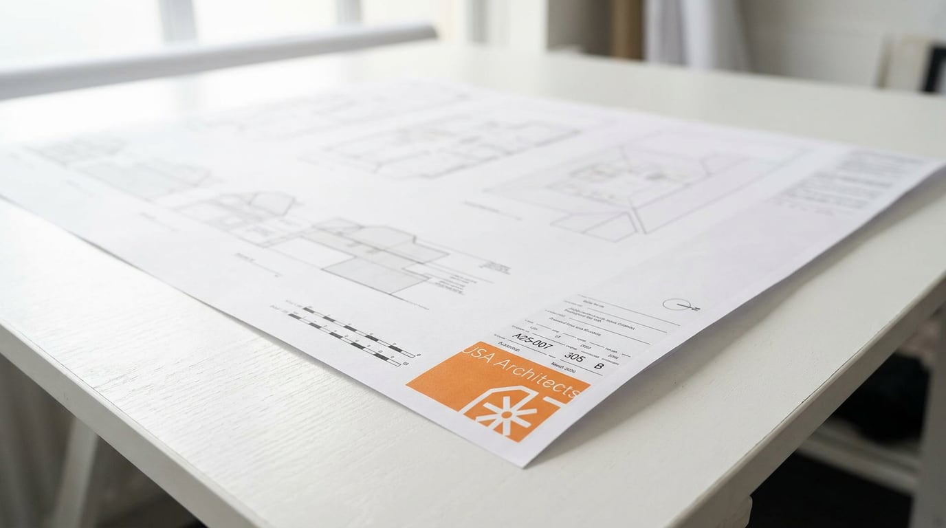
02. Design Everything built around your brief. We sketch, develop, and refine — with check-ins before anything is fixed. You stay in control without getting buried in the detail.

03. Deliver Through planning, building regs, and into construction. We handle the process. You make the decisions that matter.

Get in touch today